AIoT-Enabled Geospatial Intelligence
Real-Time Map Integration for Multi-Site Data Consolidation & Predictive Analytics
By leveraging computer vision, satellite mapping, and machine learning-based event detection, this module provides highly scalable, automated, and predictive insights tailored for multi-site operations, industrial automation, R&D, and scientific applications.

Reduced workplace accidents through proactive hazard detection
Enhanced regulatory compliance with industry safety standards
Increased operational efficiency with AI-driven risk mitigation
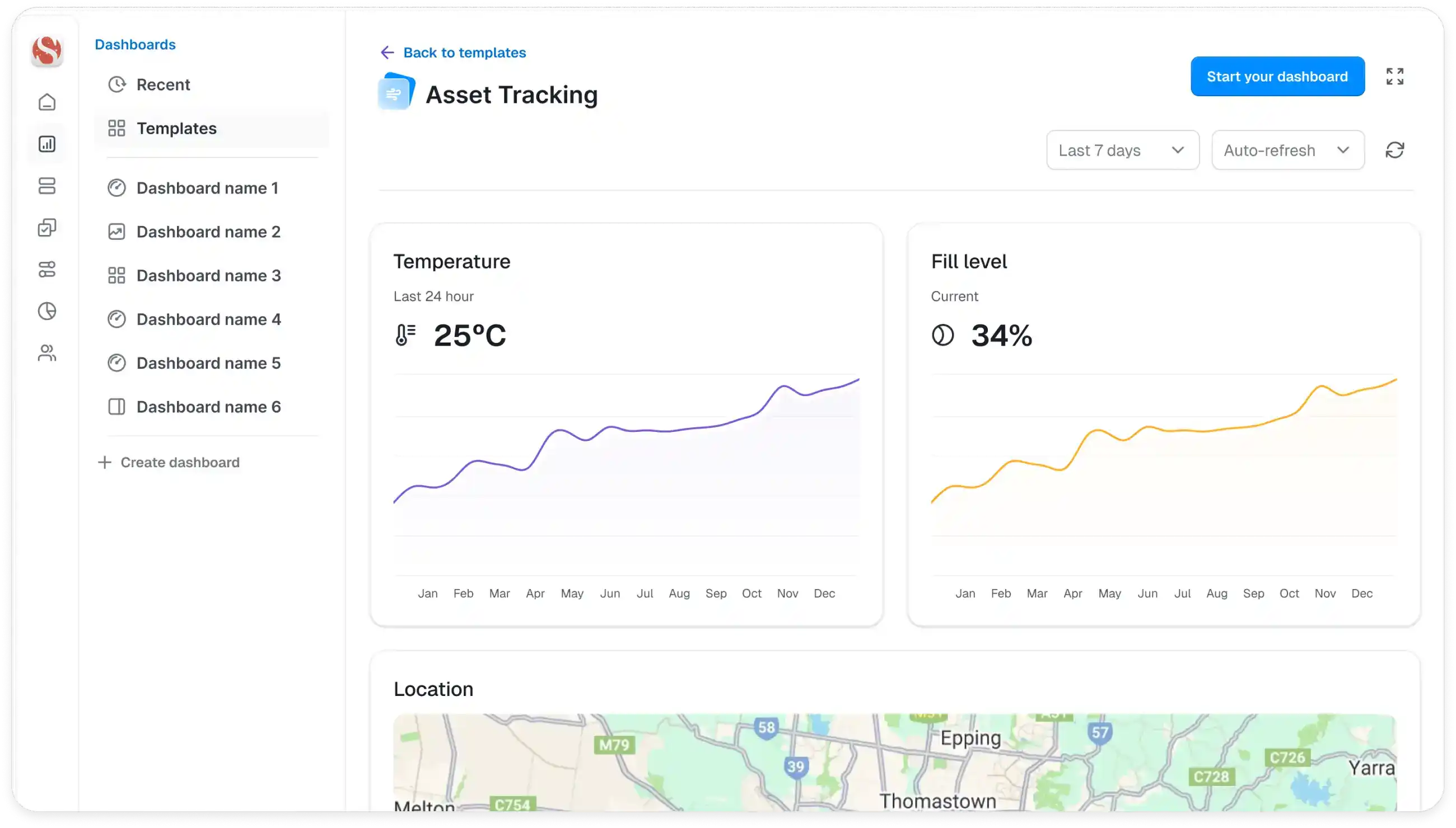
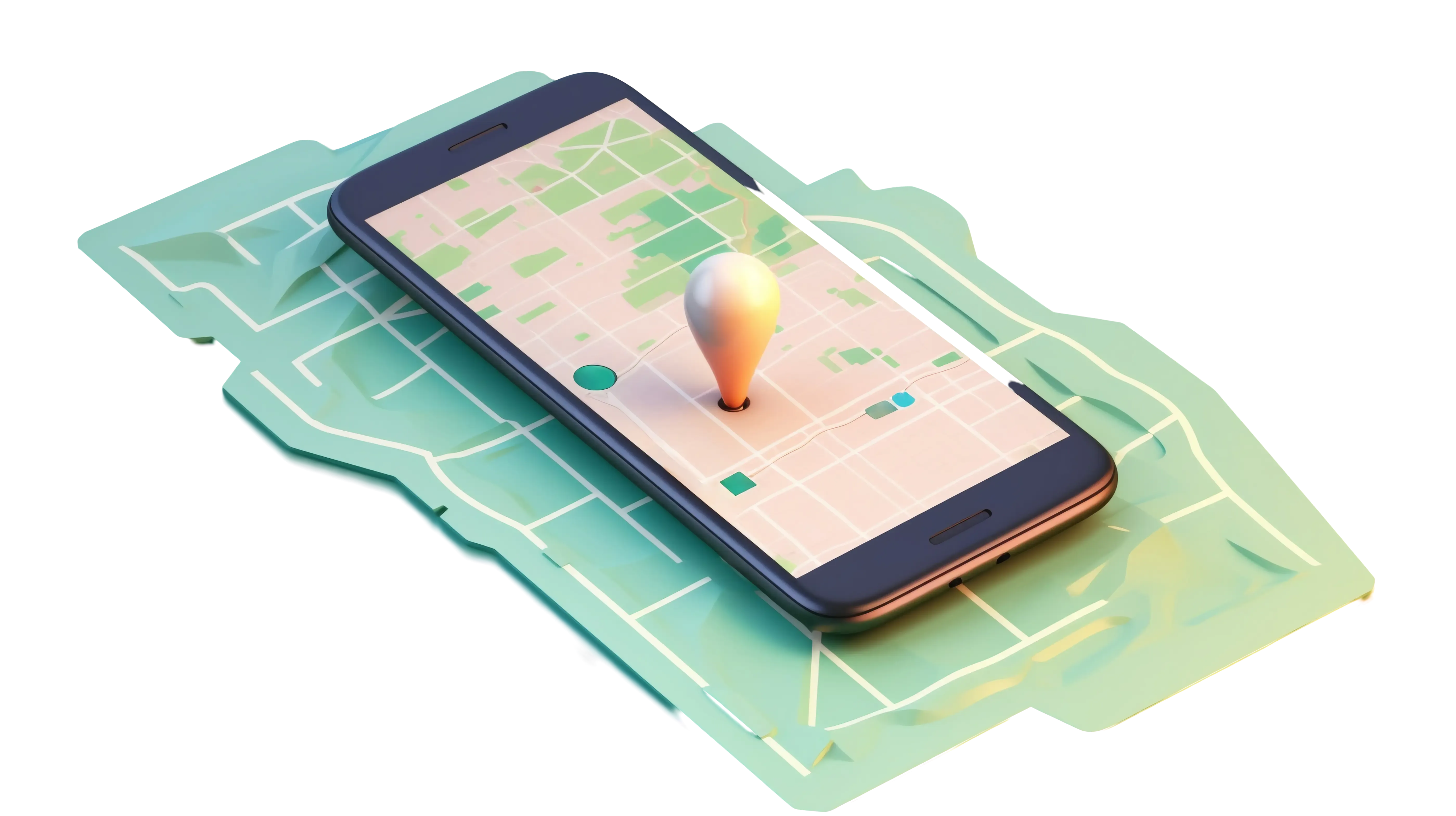
Geospatial Template
Geospatial Template offers a foundational setup for tracking and managing city’s energy consumption. This layout features an interactive dashboard with real-time insights into electricity usage, appliance performance, and energy trends. It provides a high-level overview of essential metrics to promote efficiency, reduce costs, and support smarter, more sustainable energy management.
Domain-Specific Applications for AI-Powered Mapping & Situational Awareness
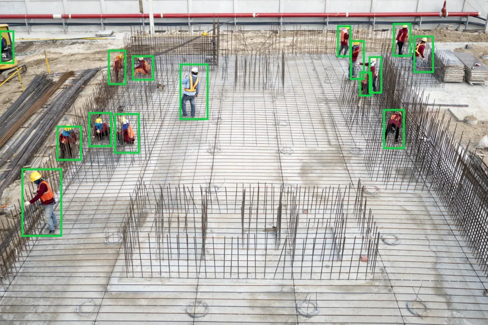
Industrial Safety & Compliance Monitoring
- AI-driven PPE compliance tracking
- Predictive risk assessment models
Smart Cities & Urban Infrastructure
- Real-time traffic flow analysis
- Automated security monitoring
Environmental & Climate Intelligence
- Geospatial AI models for tracking air quality variations
- AI-driven ecological and hydrological risk assessments
Healthcare & Clinical Trials Data Mapping
- AI-enhanced epidemiological tracking
- IoT-based remote patient monitoring
Agri-tech & Precision Farming
- Analyzes historical data to predict failures and inefficiencies
- Optimizes cooling, power usage, and maintenance schedules
Agri-tech & Precision Farming
- Geospatial crop health analytics
- AI-powered irrigation and pest control optimization

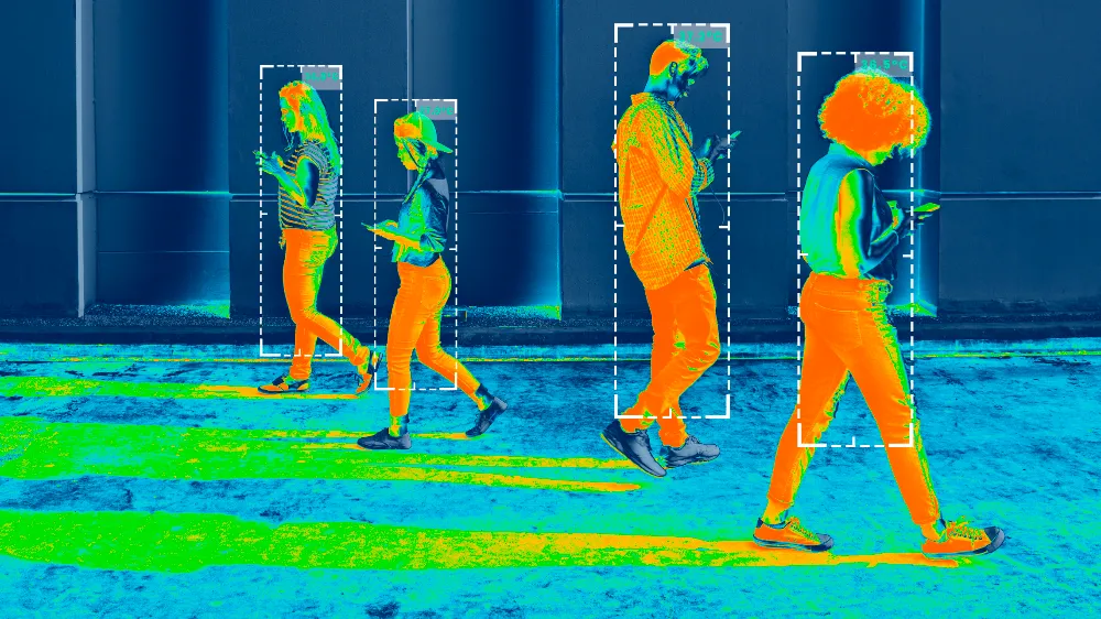
Multi-Object AI Detection & Real-Time Geospatial Data Processing
AI-Driven Object Localization & Tracking, where deep learning-based models process multi-spectral satellite imagery, drone feeds, or CCTV networks, mapping detections to dynamic, interactive geographic interfaces.
Geospatial Sensor Fusion, integrating data streams from IoT-enabled sensors, environmental monitors, and smart infrastructure, enabling real-time anomaly detection and automated event categorization.
Edge AI & Distributed Processing, where real-time inference models process and visualize high-velocity, multi-source geospatial data, ensuring low-latency decision-making across industrial, environmental, and security domains.
AI-Enhanced Geospatial Predictive Modeling & Automated Reporting
Historical Event Replay & Predictive Modeling
Where longitudinal data analysis and time-series forecasting models detect emerging trends, operational risks, and environmental shifts.
Deep Learning-Based Anomaly Detection
Utilizing spatiotemporal AI models to predict equipment failures, security breaches, and workforce inefficiencies across monitored locations.
AI-Powered Compliance & Regulatory Auditing
Ensuring automated rule enforcement, geospatial anomaly detection, and risk mitigation reporting, integrating with enterprise management platforms and regulatory databases.
Customizable Geospatial Intelligence Dashboards
Visualizing real-time AI inferences, IoT sensor feeds, and machine-learning-driven insights, fully integrable with GIS platforms, ERP systems, and AI-powered digital twins.

AIoT-Powered Geospatial Decision Intelligence
The Map Integration Module redefines geospatial intelligence, multi-site data fusion, and real-time AI-powered situational awareness. By integrating AI-driven object detection, IoT sensor analytics, and predictive geospatial modeling, this module enhances industrial automation, smart city management, environmental monitoring, and R&D applications.
AIoT real world examples
Real-time Robbery Detection with AIoT Precision
How Sensolist AIoT instantly detects unusual activity, identifies a potential robbery, and sends real-time alerts to security teams.
AIOT MODULE & USE CASES
Start your IoT journey with Sensolist
Our team is ready to assist.
We're available Mon-Fri, 9am-5pm.